Observations in Chronological order
Day 2, Oct. 8
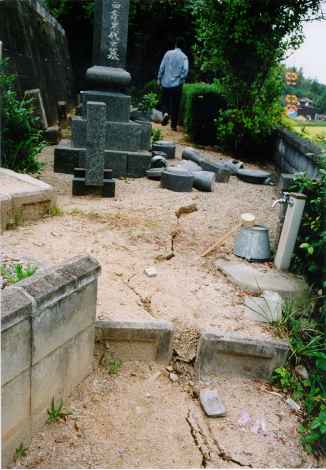
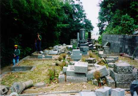
Location 2, 133o20.4'E, 35o22.1'N: Cemetary at the Kashiwao, Seihaku town.
|
This graveyard spreads over a thin terrace-like ridge sticking out towards the
narrow valley of Houshouji river. The graveyard is covered up with soft sand
of weathered granite. Cracks, about 2cm-wide, were found in the soil along
the rim of the "terrace". Almost all graves were completely destroyed.
Because of the severe destruction it is difficult to estimate acceleration
and velocity with help of the simple formulas and assumptions as done
for the cemeteries visited on the 1st day.
|
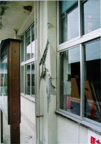
Location 3, 133o26.4'E, 35o20.6'N: Mizoguchi city hall
|
The building is closed of because of the severely damaged columns of the 1st storey
and a large cracks in the stair between the 1st and 2nd storey. Longitudinal rebars
were of plain type and stirrups were widely spaced about 30 cm. A concrete block wall
next to the building was also damaged probably due to too few and corroded reinforcement
bars. Many of the buildings in the city had damaged roof tiles.
|
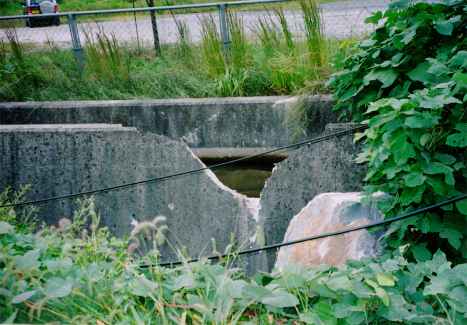
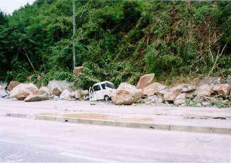
Location 4, 133o26.2'E, 35o19.9'N: Rockfall at Nakaso area.
|
A volcanic (igneous) rock wall of Pliocene Epoch (5 - 2 million years old?)
was cracked up along its joints into a number of large (about 1-2 m sized) pieces. The intact
part of the stone is gray with tiny fragments/inclusions of separate substances (most probably
Mica?). Originally exposed parts are rather brownish with small clusters of moss sticking to
the surfaces. The broken rock pieces rolled down the steep slope (?? degrees). One piece bounced
on the pavement of Prefecture Route rolled into a ditch breaking the concrete wall of the ditch. The
front part of a car was squashed, but fortunately the driver survived.
|
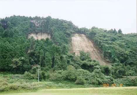
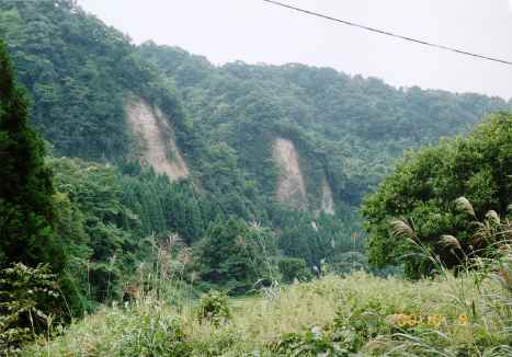
Location 5, 133o26.2'E, 35o19.1'N: Slope failures at Furuichi.
|
There is a multi-stepwise configuration in Furuichi. The slope failure took
place at the northern slope of the highest (second major) terrace. The terrace
consists of weekly-cemented sediments of volcanic soils and rocks. Cedar trees grew on the
slope face. These trees has a shallow root system and causing the soil mass, being
reinforced by the roots, to slip as a large mat.
|
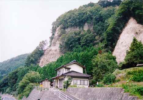
|
At a nearby cemetary located on a hill facing the Hino river the average slippage of
pillar stone located on stiffer soil were 3-4 cm. Almost all pillar stones located
on top of looser soil (probably fill) were toppled. About 90% of the still standing pillar stones
rotated counter clockwise. (photo to be put up). The peak ground acceleration has been
estimated to 500 cm/s2 and peak ground velocity to some 50 cm/s.
|
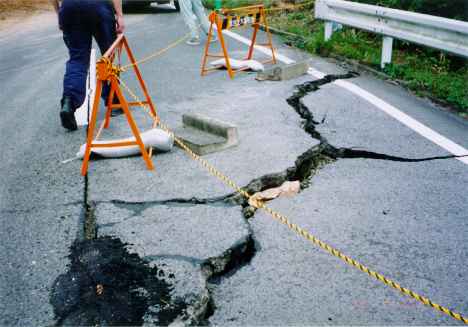
Location 6, 133o23.8'E, 35o15.3'N: Ground cracks at Fukuoka in Nibu region
|
Surface cracks found across a narrow valley situated above a cluster of after shocks.
Road pavement was also cracked. A possible fault surface rupture, but
the cracks in the soil are most probably due to small slope failures. A reconnaissance
team from Kyoto University, could neither find any evidence of fault surface rupture in this area.
|
Location 7, 133o26.8'E, 35o14.3'N: Neu, Hino town
|
Damaged roofs were covered with plastic sheets to prevent leaks in the case of rainfall.
The traffic on the Japan Railway Hakubi line was suspended due to rock falls and
slope failures. (Picture not scanned yet.)
|
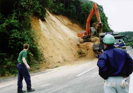
Location 8, 133o28.1'E, 35o19.2'N: Rock falls along Otaki-Shiramizu prefectural route
|
Taking a detour through Neubara, we came up to Osaka, a small village along the
valley formed by river erosion through a thick sediment of volcanic ash, pumices
and other suspended matters carried by pyroclastic flows from Mt. Daisen. The
weekly-cemented soil appearing on upright cliffs is totaly white, and once soaked up
with water, it looses bond among grains. A big piece of rock was found broken in pieces
on a asphalt pavement. White radial lines remaining on the pavement tells that the rock
flew in pieces in all directions.
|
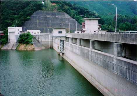
Location 9, 133o19.9'E, 35o18.0'N: Kashoo dam
|
The concrete gravity dam withstood exceptionally high accelerations;
530 gal at the base in the North-South direction and 2200 gal at the crest in the
North-South direction. Only some minor damage was observed. The machine room of the outlet sub-gate
in the center of the picture (photo taken from east abutment) had some diagonal cracks
in the concrete and the windows were broken. The west abutment parking lot settled
about 10 cm causing cracks in the asphalt pavement. An engineer in the control
room located at the west abutment told that he could not remain standing during the shake.
|
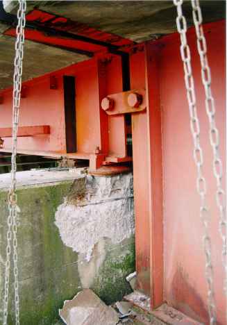
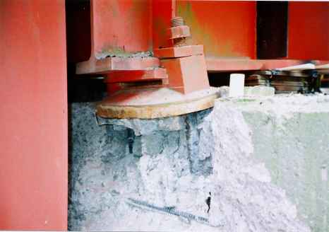
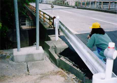
Location 10, 133o19.6'E, 35o17.9'N: Hakusan bridge
|
A two-span simply supported steel girder bridge located on the west side of the Kashoo dam
reservoir. Two abutments and one wall-type
reinforced concrete pier in the middle support the bridge. The heights of girders
differ reflecting the difference in length of the two spans. The top of the pier thus
has a stepwise shape. The road, and followingly the bridge, is slightly inclined upward
to the upstream side of the Kashoo dam (Did not measure the inclination). The backfill
of the southern end abutment has subsided by about 18 cm causing the girders for the
upstream span of 18m to be pushed downstream towards the middle pier. This seems to have
caused the bearings of the girders at the pier to be pushed outward in such a way
that the parapet between lower and upper decks of the pier was cracked/spalded into
large pieces of concrete, which were found remaining on the lower deck of the pier. This damage
caused the bridge girders to settle a few centimeters as can be seen from the nut on the bearing
bolts. The expansion joints of the bridge deck were almost closed.
|
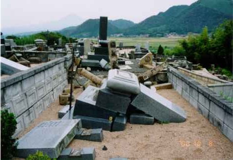
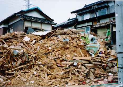
Location 11, 133o20.1'E, 35o21.1'N: Collapsed house and Cemetary at Aga, Saihaku town
|
One of the few collapsed buildings. At the nearby cemetary almost all graves were destroyed.
One gravestone rotated more than 135 degrees without toppling. Ground accleration was
estimated to more than 500 gal and velocity to some 90 cm/s.
|
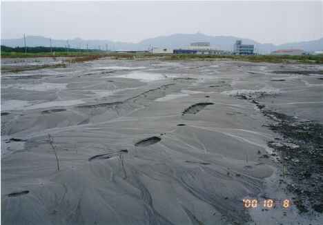
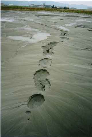
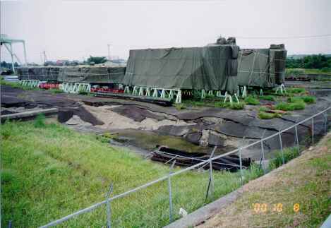
Location 12, 133o15.3'E, 35o31.4'N: Exstensive liquefaction at Sakai minato dream port park
|
Wide-spread liquefaction causing lateral spreading and sandboils. Quay walls moved slightly outward causing
joints between concrete pavement slabs to open up. Some cracks could be seen in the pavement.
Numerous large sandboils in parking lot. Retaining walls along channel moved towards channel
due to heaving failure. The soil was gray very fine silty sand.
|
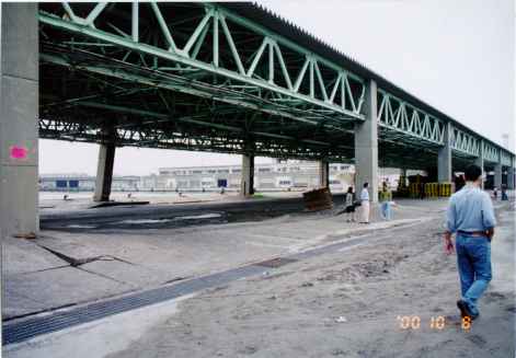
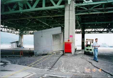
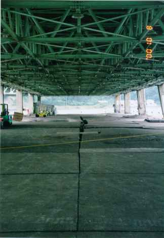
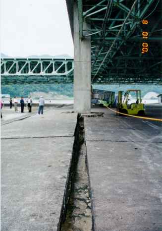
Location 13, 133o15.1'E, 35o32.6'N: Sakai minato fisherman's wharf
|
The wharf has a roof along its sides, each side being supported by a two row of concrete
columns. The concrete pavement slabs settled up to 1 meter due to liquefaction, while the
pile supported columns did not settle. Lateral spreading pushed quay walls towards the water
and causing one of the columns to tilt. The area is closed off from use. A large amount of
liquefied sand could be seen in drainage channels along the wharf. The two lower photos show
the large opening of the joints between the concrete slabs caused by the lateral spreading.
|
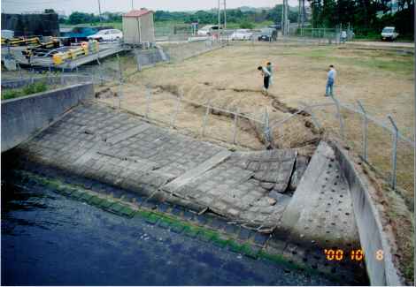
Location 14, 133o12.2'E, 35o30.8'N: Nakaura water gate
|
Quay wall failure at the Nakaura water gate. A possible scenrio could be: The liquefied backfill
soil squeezed through openings between quay wall blocks causing settlement behind
the quay wall and subsequent failure of the quay wall because the backfill is "eroded" away.
Another scenario could be: Lateral spreading caused the quay walls to fail allowing the liquefied soil run out into the water, with
subsequent settlement/slope failure behind the quay wall.
|