Flyover on Google earth
- Tokyo Bay Shore Areas liquefied in the M9.0 March 11th, 2011 Great east Japan EQ (148MB)
The March 11th, 2011 Off the Pacific Coast of Tohoku Earthquake, also known as the Great East Japan Earthquake, has shown that a long stretch of landfills along northeastern shorelines of the Tokyo Bay had very high susceptibility to liquefaction, causing concerns about re-liquefactions of the area in the scenario earthquake expected in the capital's metropolitan area. An attempt was made to detect soil subsidence from raster images converted from airborne LiDAR (Light Detection and Ranging) data before and after the earthquake. To eliminate deep-seated tectonic displacements and systematic errors of LiDAR surveys, the template matching technique is used for clusters of pile-supported buildings and bridge piers chosen as templates in source images of the target areas.
The “Google Earth tour” flying about 1.5km over the liquefied Tokyo Bay Area from Urayasu to Chiba provides you with the spatial distribution of soil subsidence in great detail.
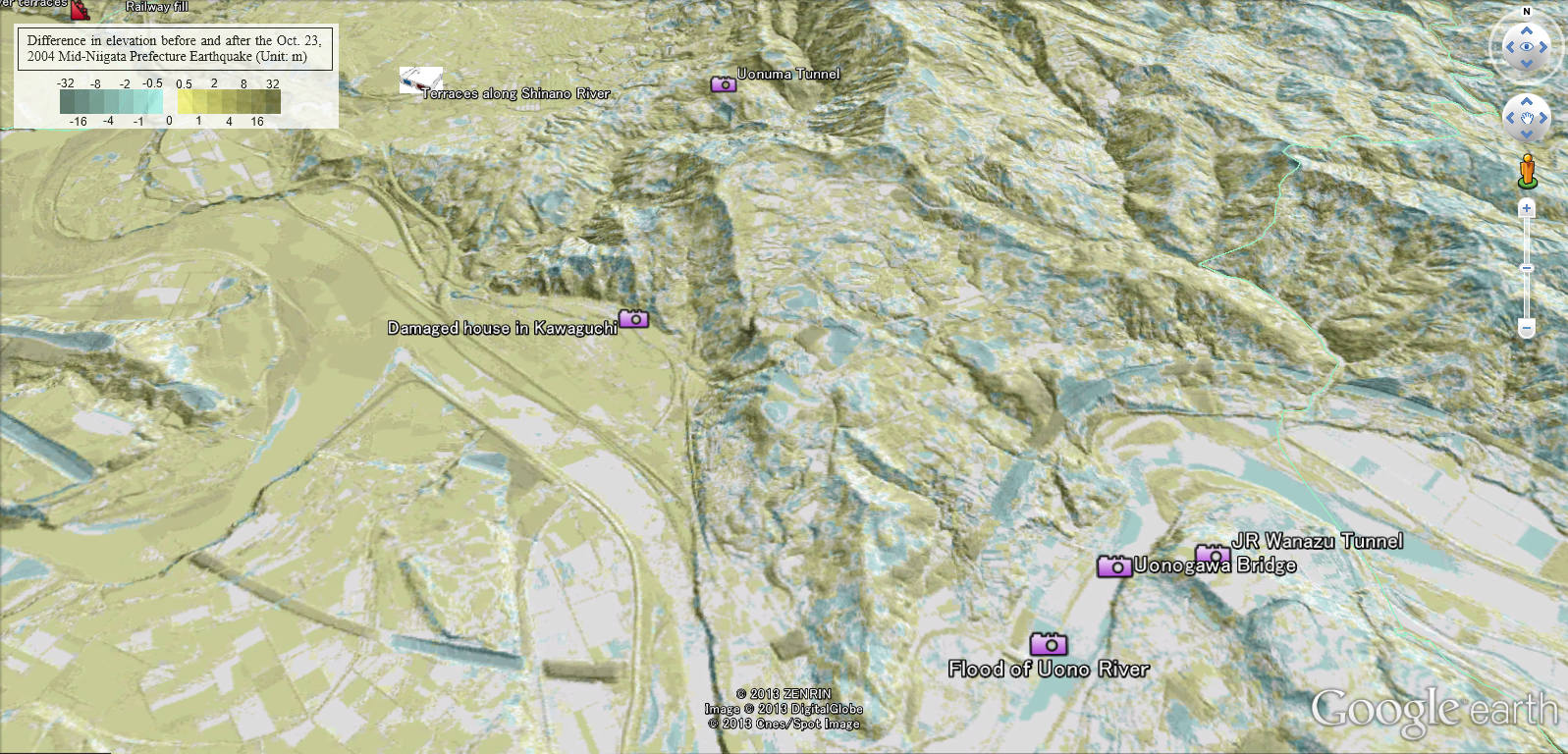
- Difference in elevation before and after the M6.8 Oct. 23rd 2004 Mid-Niigata Prefecture Earthquake (4.5MB) An intense earthquake of magnitude 6.8 jolted central Japan at 17:56 JST on October 23rd, 2004. The hypocenter of the main shock was located at 37.29°N, 138.87°E, in mid Niigata Prefecture, at a depth of 13 km. The earthquake triggered thousands of landslides in the Mid-Niigata Mountain terrain. To deal with these problems in a scientific manner, a research program, "Earthquake damage in active-folding areas: creation of a comprehensive data archive and suggestions for its application to remedial measures for civil-infrastructure systems," was set up getting the Special Coordination Funds for Promoting Science and Technology, Ministry of Education, Culture, Sports, Science and Technology (MEXT) Ref. [5]. This program was unique among many other MEXT-funded research programs in that an advisory panel was set up under the Japan Society of Civil Engineers including not only researchers but also experts from authorities such as Niigta Prefectural Government, Ministry of Land, Infrastructure, Transport and Tourism (MLIT) etc, all concerned about rehabilitation affairs. The idea was to facilitate real-time research information sharing among relevant organizations for rational rehabilitations. To study landform changes, core members of the program, have obtained digital elevation models (DEM hereafter) at 6 different times using stereoscopy for the pre-erathquake time of (1) 1975-1976 and Laser Imaging Detection and Ranging technology (LIDAR) for the post-earthquake times of (2) Oct. 24, 2004, (3) Oct. 28, 2007, (4) May 2005, (5) May 2006, and (6) May 2007. Landform changes due to the earthquake were first assessed. The figure below shows that the left half of the birds-eye image is ocherous indicating that this area has been uplifted due to deep-seated tectonic deformation.
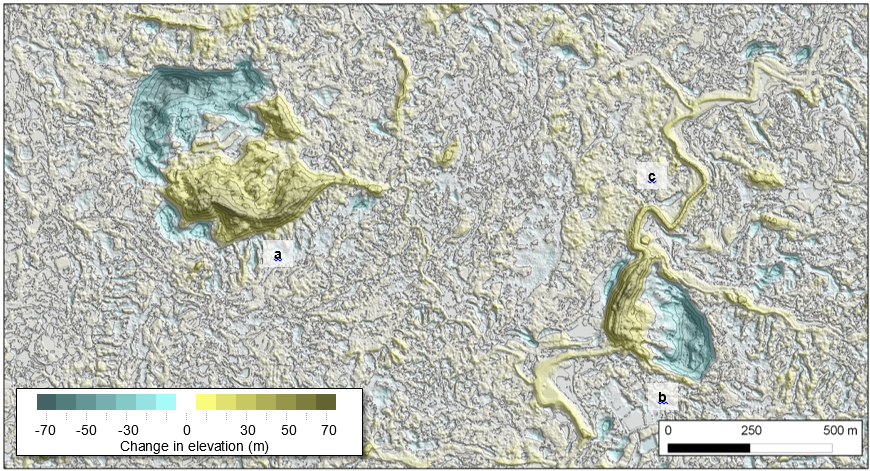
- Change in elevation caused by shallow subsurface soil displacements in the 2004 Mid-Niigata prefecture Earthquake Then, changes in elevation in Eulerian description for DEM were converted to Lagrangian displacements, and the obtained Lagrangian ground displacements were further resolved into shallow and deep seated displacement components (Refs. [6], [7] and [8]). The change in elevation caused by only shallow subsurface soil displacements shown in the figure below highlights the locations of large landslides such as (a) Dainichi-yama landslide, (b) Higashi-Takezawa landslide, and (c) the increased river bed of Imokawa blocked by the Higashi-Takezawa landslide mass.